Wednesday, June 12, 2013

Yeti is taking a break for the summer of 2013 and being readied for another deployment to Antarctica in the fall of 2013 for a new project to study the flow and fracture dynamics of the McMurdo Shear Zone through funding from the National Science Foundation.  Stay tuned for additional updates on this project over the next three years!

Yeti's sister, the Cool Robot, is currently deployed to Greenland to perform aerosol studies in the vicinity of Summit Camp, and to study ice-melt features in the ice later at Summit.  You can follow the Cool Robot's journey at coolrobotgreenland2013.blogspot.com

Congratulations to Rebecca Williams, who received her Ph.D. degree this past week and has embarked on the next phase of her own journey.  Go Becca!

Monday, March 11, 2013

Yeti Surveys Warren Cave

After some debugging and testing, we performed some autonomous GPR surveys at Warren Cave.  Warren is one of several fumoralic ice caves that Mt. Erebus scientists enter to measure temperature, gas concentrations, and morphology.  Our LiDAR team, Jed and Drea, went into Warren Cave a few weeks ago to perform green LiDAR scans of Warren's interior.  I was lucky enough to accompany them and help out when I could.

Entrance to Warren Cave. 
In order to enter the cave, we had to anchor ourselves to stakes driven into the rock in case the cave ceiling collapsed under our weight.

Inside Warren Cave looking out.
Yeti did pretty well on the snow over Warren, except for some icy patches here and there. We set up a mountain tent as a staging area for Yeti's electronics, including a large DC car battery, an inverter, an extra GPR, extra laptop batteries, and extra Ultralife batteries.


Recent Yeti Press

Yeti has been getting some great press recently; read on!

Curiosity’s Cousins: Autonomous Polar Robots Explore Earth’s Extremes
Wired
Earth’s poles are the wheeling grounds for two polar rovers: solar-powered Cool Robot and its younger cousin Yeti.  The pair, designed by a team led by engineer Laura Ray at Dartmouth College, are among the first autonomous polar robots to go to work. Now, knee-high Yeti is on an expedition to Antarctica, peering beneath the ice and snow on Mt. Erebus, in search of steam-carved caves hiding in the volcano’s ice cap

How a Robot is Changing the Game of Antarctic Science
Wired

 The trek across the Antarctic ice sheet is a long, hazardous, and costly journey for scientific researchers working in the world’s most remote location.  Astronomers, geologists, and biologists regularly spend much of their field season and over 70% of their hard-earned grant money on logistical support – an intricate choreography of supply planes, snowmobiles, and tractors meant to move gear to where it needs to be

'Yeti' robot warns of Antarctic crevasses
Bend Bulletin

You’re traveling more than 1,000 miles across the barren snowscape of Antarctica. Along the way, many crevasses lie hidden between you and your quest to resupply the hungry scientists at the Amundsen-Scott South Pole Station. The good news is you can detect these deathtraps with a radar arm. The bad news is it only gives you approximately four seconds of warning before you and your tracked vehicle,...

Roving around Erebus
Twenty years after an arachnid-shaped robot stalled out on its descent into the noxious crater of an Antarctic volcano, an altogether different rover could be found on the slightly safer slopes of Mount Erebus.

'Yeti' Robot Finds Cracks in Antarctic Ice
CRASAR
A new robot has found its way to Antarctica. This robot is called 'Yeti', this little robot runs ahead of convoys and other larger vehicles looking for cracks that the ...


'Yeti' Robot Finds Cracks in Antarctic Ice
Discovery News

 Meet Yeti, a faithful rover of the robotic kind that sniffs out dangerous crevasses for convoys crossing the glaciers of Antarctica and Greenland, explores ice caves on an active volcano and finds old buildings buried under the polar ice.

Robot Yeti Helps Researchers in Polar Areas
French Tribune
Researchers being funded by the National Science Foundation have recently started to take help of a self-guided robot named Yeti for exploring the Arctic and Antarctic area. This robot helps in identifying the crevasses that are hidden in the thick ...
 

In Greenland and Antarctic Tests, Yeti Helps Conquer Some Abominable Polar Hazards
National Science Foundation

A century after Western explorers first crossed the dangerous landscapes of the Arctic and Antarctic, researchers funded by the National Science Foundation (NSF) have successfully deployed a self-guided robot that uses ground-penetrating radar to map deadly crevasses hidden in ice-covered terrains.
 
Yeti Robot Finds Deadly Antarctic Crevasses So We Don't Have To
Slate Magazine
Meet the Yeti. This four-wheel-drive rover drags a ground-penetrating radar arm capable of logging information that tells scientists what lies—or more importantly, doesn't lie—below. At just 180 pounds, the bot crosses snow-covered crevasses like it ...


In Greenland and Antarctic Tests, Yeti Helps Conquer Some Abominable Polar Hazards
Alaska Native News
Phys.org
A century after Western explorers first crossed the dangerous landscapes of the Arctic and Antarctic, researchers funded by the National Science Foundation (NSF) have successfully deployed a self-guided robot that uses ground-penetrating radar to map deadly crevasses hidden in ice-covered terrains... 

Occupational Health and Safety Online
Researchers funded by the National Science Foundation have developed a self-guided robot that uses ground-penetrating radar to map crevasses hidden in ice-covered terrains. They believe the robot, named Yeti, will make Arctic and Antarctic explorations and missions to resupply remote scientific stations safer, NSF reported March ...

RedOrbit
A century after Western explorers first crossed the dangerous landscapes of the Arctic and Antarctic, researchers funded by the National Science Foundation (NSF) have successfully deployed a self-guided robot that uses ground-penetrating radar to map deadly crevasses hidden in ice-covered terrains

Wednesday, December 26, 2012

Yeti Arrives at Mt. Erebus

After a frustrating 5-week delay, Yeti has finally arrived at LEH.  Due to a series of very unfortunate events, he's been stagnant at various locations since his "arrive-by date" of November 22nd.  Just this last week he's spent on the helicopter pad at McMurdo Station, waiting for weather to clear.  Since the only way to get up the volcano is by helicopter, we are completely at the behest of weather.  For some reason, it seems that the conditions are always opposite at LEH and McMurdo.  Most of the time, the weather up on the volcano is beautiful and clear, and we are above the clouds, and McMurdo is "hot," cloudy and snowy.  We rarely get any snow up here. 

It seems so long ago that Jim and I packed up Yeti in his box.  He is really easy to helicopter in, because he's exactly square, and can be slung by a helicopter.  Below is Yeti's arrival this morning.


This was our first helicopter in over a week, and we were also very happy to get butter and some "freshies."  We also said a sad goodbye to our UNAVCO friend Marianne Okal, who was doing some LiDAR of the crater and surrounding areas.

First look at Yeti in more than a month!  We asked the helicopter to drop the sling near the "RAC tent," or rapid-assembly-something tent, which ended up being the science staging area.

Yeti's first steps on Mt. Erebus, his flag blowing nobly in the 20 knot winds. 

Today Drea and I will go to Warren Cave to set up a tent so we can watch Yeti surveying from relative comfort, and so the laptop will continue to function.  Yeti's first survey will be around LEH to get him warmed up, then to Warren cave, for which we also have LiDAR data. 


Wednesday, December 19, 2012

LiDAR at Mt. Erebus

Today we said goodbye to Kevin Mickus (gravity man) and Jed Freschette (LiDAR man), two of our awesome team doing awesome science at Mt. Erebus.  In my previous post I described Kevin's gravity work, and here I'll describe Jed's LiDAR work, which ties into my ground penetrating radar surveys. 

LiDAR stands for Light Detection And Ranging, meaning it detects light (laser light, specifically) and also computes the distance the light has traveled.  A laser is shined at an object, which reflects and back-scatters that light, which is then received and analyzed by the LiDAR unit. Lasers are used because they produce a very narrow, intense beam of light, from which a reflected signal can be accurately associated with a specific point on the object of interest.  Therefore, LiDAR can obtain very fine resolution.

There are several types of LiDAR with different applications:
  1. terrestrial (urban, forrestry, etc)
  2. airborne (down-looking from airplanes, helicopters,
  3. space-borne - nir
  4. atmospheric (maps column of air space above) - green
  5. mobile
LiDAR is a popular tool for use in the cryosphere, because the landscape offers little contrast for traditional imaging methods.

Here on Mt. Erebus, scientists Jed Freschette and Drea Killingsworth are using LiDAR to map the accessible rooms of ice caves formed by the volcano.  This not only gives location, and extent of the caves, but an idea of volume and structure as well.  


LiDAR unit upon a tripod, with a target and tripod in the background.  Each scan round must have a GPS location, or be co-located to a dataset with location information.

LiDAR in the process of scanning the ice cave with green laser.  The swath of light is made by a rapidly scanning laser, and moves through a 270 degree field-of-view.

Sunday, December 16, 2012

Measuring Gravity at Mt. Erebus

Measuring gravity changes at Mt. Erebus will help measure the "plumbing" of the volcano or, how the magma flows within the volcano.  Our gravity man, Kevin Mickus, uses a gravimeter to measure local gravitational fields at many points around Mt. Erebus.

Gravity Principles

Though it's often drilled into our head during Physics I,II,III etc that the acceleration of gravity on Earth is 9.81 m/s^2, gravity at specific points on the earth changes due to various parameters.  Gravity changes with elevation, latitude, earth tides of the crust from the moon, and air pressure, to name a few.  In addition, the density of an object affects its gravitational acceleration and direction. 

Here at Mt. Erebus, gravity caused by the Earth is greater because we are at a pole rather than the equator.  Reasons for this include the "equatorial bulge," and the increased inertia caused by Earth's rotation.  The "bulge" results in a greater distance between and object and the Earth's center as compared to at a Pole, and therefore that object experiences a weaker gravitational pull.  The same rationale is applied to gravity at high altitudes.  The effect of altitude can be quantified by the following equation:


For studies of Mt. Erebus (we are currently at 11,500 ft. above sea level), we want to remove all these effects in order to obtain gravitational anomalies related to different densities of the volcano rock.  Denser material causes higher local gravitational fields, whereas the opposite is true of less dense material.  The two material extremes on any volcano are dense rock and less-dense magma.  Measuring gravity at Mt. Erebus can help locate where magma chambers exist.  Higher gravity measurements mean dense, cool volcanic rock, whereas lower gravity measurements mean less dense, hot magma.  The differences in gravity between these two extremes are very small.

The location and flow of magma reservoirs within a volcano are key to understanding its dynamics, including magma "plumbing system," volcano deformation, temperature distribution, and eruption mechanisms. 

Measuring Gravity

Gravity anomalies are measured with a gravimeter, and measured in milligals.  A Gal is a unit of acceleration that is used only in the field of gravimetry, and is 1 centimeter per second squared (cm/s^2).  When measuring the densities of rocks, precision is on the order micro-gals.

Though its cost is significant, a gravitometer is essentially a spring and a mass system.  The spring counteracts the force of gravity pulling on the test mass. Then change in length of the spring may be calibrated to the force required to balance the gravitational pull. 


Wednesday, December 5, 2012

Monitoring Mt. Erebus at Lower Erebus Hut (LEH) Observatory

Lower Erebus Hut (LEH) at the base of Mt. Erebus crater.  Photo: Rebecca Williams

The Lower Erebus Hut (LEH) is the main monitoring station of the Mt. Erebus Volcano Observatory.  This is where we prepare and eat our meals, use our computers with mediocre wireless internet, play bananagrams, and wait out the storms.  The above photo was taken during a weather day with very poor visibility and near whiteout conditions.  The hut seats about 14 max.  

LEH monitoring station.
Infra-red camera image of the lava lake within the crater
Real-time stream of gas concentrations in the crater's plume.

The hut's monitoring station includes a real-time stream of four gas concentrations in the plume rising from the crater, and an infra-red camera image of the lava lake at the base of the crater. The plume results from degassing of the lava lake.

Current research consists of
  1.  continued monitoring of the SO2 flux from the lava lake
  2.  measuring the CO2 emissions from the lava lake and summit
  3. geochronology of the summit and flank lava flows
  4. continued monitoring and interpretation of seismic and seismoacoustic activity volcano through the use of a network of highly-sensitive broad-band seismometers
  5.  establishing a GPS base network to monitor the short- and long-term deformation of the volcano

Tuesday, December 4, 2012

Yeti Goes to Mt. Erebus, Antarctica

Yeti's next adventure is his maiden voyage of science!  This current deployment will be the first ALL SCIENCE campaign to the Poles, which is very exciting for proving his utility for scientific applications as well as for logistic support. 

Yeti will be accompanying an 11-person team of scientists studying Mount Erebus, the highest and southern-most active volcano in the world.  The Mount Erebus Volcano Observatory (MEVO) at the New Mexico Institute of Mining and Technology has been monitoring Mt. Erebus since 1972.  At the head of our team is Phil Kyle, one of the pioneering scientists of Erebus who will be celebrating his 40th season this year. 

Yeti's role in this year's Erebus season will be to collect ground penetrating radar (GPR) images of ice caves that form within the snowpack surrounding the crater.  These caves are formed by fumaroles, which are openings in the volcano that emit steam and various gasses.  Microclimate, heat transfer, extent, and structure are just some of the scientific aspects that are of interest. 

A view of Mt. Erebus from approximately 30 miles south.  A small plume of gas escapes on a nearly windless day.


Thursday, November 1, 2012

Yeti at Old Pole: Part II

The Survey:


The figures below show a floor plan for the hazardous areas, and Yeti's survey tracks for exploring the sunken building.


Figure 1 shows a map of the area of interest surrounding Old Pole. It measures about 445’ x 200’ and includes the three blast craters from 2010 (~ 325 ft long x 80 ft wide) and surrounding border areas. The two 2010 vehicle penetrations were at the western (left) end of the site.
Following 2010 blasting operations, South Pole personnel flagged the site (blast crater and ~ 60-ft-wide boarders) and these flags were in place upon our arrival on 29 Nov 11 to delineate the survey area. We acquired the GPS coordinates of the corner flags and divided the boundaries into waypoints ~ 10-ft apart to generate the survey grids.

As seen in the above figure, coverage was comprehensive and more than adequate for site assessment, although not as rectilinear as desired. Simple improvements to the algorithm, such as adding waypoints outside of the survey area to align Yeti for the next pass, would certainly improve grid geometry. Our tight deployment window prevented us from implementing these improvements.

The GPR data files were reviewed by Alan Delaney in Texas to determine the effectiveness of last year’s blasting activities and to identify whether any potential subsurface hazards remain prior to planned backfill- hardening of the area. Familiarity with the 2010 GPR dataset and the Old Pole station layout greatly facilitated the review process. Knowledge and experience from crevasse detection during overland traverses also played an important role in reviewing the GPR data.

The Results:

1. Buildings A15 and A21 at the eastern perimeter of the site, outside of the blast crater, appear to be intact at depths approximately 10-15 ft below the surface.    Figure 4 shows a typical radar sequence across this area. These structures could pose hazards to vehicles.

2. Strong returns in an area approximately 20-ft x 20-ft near the expected location of building A10 suggest an intact building at 11 - 13 ft below the surface. The figure below shows a typical radar sequence. Although this area is just east of the map location of A10, uncertainties in map geo- registration could account for the difference.


The Conclusions:


1. Yeti was an effective platform to conduct GPR surveys over a potentially hazardous site. He operated reliably at temperatures below -30C and displayed excellent mobility over the natural, rough snow surface at South Pole. Simple improvements to his navigation algorithms and software for survey planning will increase his effectiveness at low cost. For specific local sites, such as South Pole and the McMurdo shear zone, adding a differential GPS base station would improve survey accuracy and repeatability. Long-endurance rovers, such as the solar-powered Cool Robot, could similarly perform useful GPR surveys over longer distances in Antarctica to develop safe routes for science and cargo traverses.

2. Off-site data transfer is a feasible way to access scarce GPR interpretation expertise. Data transfer rates from South Pole are adequate for daily analysis and feedback to field personnel. Besides the radar data, track maps (from autonomous or manual surveys) must also be transferred to allow the analyst to form a clear picture of survey conditions. A key advantage for the present study was that the off-site expert had previous experience with the Old Pole site, having conducted the 2010 GPR survey and assessment. However, access to extensive background information, such as drawings, maps, etc., is essential for anyone off-site to develop a clear understanding of the survey. To aid this, the off-site analyst should possess the same Geographic Information System (GIS) package used on-site to map the surveys.

3. Good communication tools, timely review of the data, and follow-up discussions via telephone are essential to ensure an effective survey with off-site analysis. About one day’s worth of review time is needed for each day of survey data collected.

Thursday, April 26, 2012

Yeti at Old Pole: Part I

When last I posted, Yeti was off to a moonlighting gig at South Pole Station.  Here I'll talk a little bit about the history of the station, and about Yeti's great success there this past season.

South Pole Station

More formally called Amundsen-Scott South Pole Station, the site of American-owned scientific research stations is located at the southernmost latitude of the world — the Geographic South Pole.  As with most "box-sitting-on-snow" structures located in Polar regions, the original station, built in 1956 is now buried and partially demolished under the snow.  The new station, or "New Pole" was built in 2003 in a better location, this time sporting elevated building designs to prevent burial during accumulation seasons and from snow and ice advection.

Artist's rendition for plans of the original Amundsen-Scott South Pole Station in 1956.  Hervey Garrett Smith (© 1957, National Geographic Society), from www.southpolestation.com


In 2010, the buried structures from "Old Pole" were demolished using explosives, in efforts to remove vacancies and voids that would be hazardous to vehicle traffic.  This need was determined after one situation in which a tractor meandered over the area resulted in a collapse of the overlying snow, requiring a rescue vehicle to retrieve the fallen.  As the rescue tractor approached, it too succumbed to an unknown void from buried passageways from the Old Pole structures.

Before they set the charges to blow 325 ft by 80 ft craters over the structures, a GPR survey was performed to locate them.  Subsequently after blasting, the accumulation season filled the crater to the surface.

More info on the Old Pole blast can be found on the Antarctic Sun.

Yeti at Old Pole

Yeti was called in to duty for this GPR survey because of his obvious prowess in these types of situations: requirements of low ground pressure, complex survey patterns, GPR towing, and of course, taking human risk completely out of the picture.   

Yeti arrived at Old Pole on Dec 3 2011, and performed his surveys according to pre-programmed GPR waypoint files.  Typically, the GPS received information from 10 - 12 satellites and reported position accuracies of 2 - 10 ft., excellent results for 90 deg south.   Yeti displayed excellent mobility over natural snow near the site and performed well, mechanically and electrically, after being left outside each night at temperatures ranging from -29C to -33C.

Yeti conducting his survey at Old Pole.  Courtesy of Jim Lever 2011

Yeti conducted his autonomous GPR surveys in grid patterns on three successive days. The first two grids crossed the site roughly north-south and the third grid crossed it east-west. He collected GPR and GPS-position data concurrently. The consistent speed of the rover (~ 2.7 mph) combined with GPR settings tuned for the site (including scan acquisition rate, snow dielectric permittivity, and pulse time window) produced high quality GPR data. Yeti's small footprint and turning ability allowed him to execute closely spaced transects more easily than a manually operated platform such as a Pisten Bully or Tucker tractor.

GPR data files and GPS track maps were transferred during early evening satellite passes for expert analysis by Allan Delaney (my mentor in Greenland), who was located in Texas. Limited evening satellite access set the day’s schedule to ensure that all data were available for off-site review before the next day’s surveys. In all, over 325MB of data were transmitted and reviewed remotely.

The GPR data files were reviewed to determine the effectiveness of last year’s blasting, and to identify whether any potential subsurface hazards remain. Knowledge and experience from crevasse detection during overland traverses played an important role in reviewing the GPR data, since Yeti was essentially searching for voids just as he does in the shear zones.

In the next post, I'll talk about what Yeti found, and how he was beneficial to this effort.


Thursday, November 3, 2011

More Yeti Press

More links to news reports on Yeti:

Scientific American: Harnessing Robots to Study Inaccessible Arctic
MSNBC: Rover Goes For Test Drive Around Polar Regions

Wednesday, October 26, 2011

Crevasse Detection: what to do when you don't have ice

The end of summer and start of fall has proved a tumultuous time for Yeti. The shortage of funds and lack of ice breakers means Yeti will not be allowed to go to Antarctica for the Traverse, though he has picked up a moonlighting gig at South Pole Station. The old, buried station seems to be giving tractors a rough time, and Yeti will do a few grid searches with his GPR to locate pipes, empty spaces, and the like before new construction begins.

In the meantime, what does a Polar robot do without snow and ice? The answer, surprisingly enough, is dry, hot sand! It turns out that very dry sand has similar electrical properties as snow and ice, and it's possible to build a scale model of a crevasse in the lab.

So, all Yeti needs is a nice big space to build a huge sandbox. The crevasse itself can be modeled with good old fashioned polystyrene, which has the same electrical properties as air! We'll make an inverse "mold" of a crevasse with polystyrene in a wedge shape and place it in a large container (dumpster, swimming pool, pit, etc), and pour in the sand. To create striations we can intersperse some ply-wood or drywall layers.

The problem with scale models for GPR is a need for different radar frequencies. Lower frequency radio waves emit less power, but penetrate much deeper. High frequency pulses give off lots of power, but their depth penetration is shallow. If our model is smaller than a real crevasse (it better be; some crevasses penetrate deeper than 50 meters!), we don't want the GPR energy radiating deeper than our model, because then we will get signals from the floor, the building foundation, and anything in-between! We currently use 400 MHz antennas with a SIR-3000, which can image 25 meters deep in ice! We'll need to switch to a much higher frequency antenna, preferably in the giga-Hertz range. Common frequencies are 2.1 and 2.6 GHz. Then, we can scale a crevasse by at least a factor of 5. A 12.5 meter deep crevasse then could be modeled with a 2.5 meter deep polystyrene wedge buried in dry sand.

Yeti and I will continue to be resilient in the face of adversity. Stay tuned.

Sunday, August 21, 2011

Intro to Crevasse Detection

I thought I would provide some more background on my work in crevasse detection. Suk Joon and Tom Lane did a great job chronicling their efforts at Summit to equip Yeti with an instrument sled and control code. However, sample acquisition is only one of Yeti's many capabilities. His other profession, of course, is crevasse detection.

What is Crevasse Detection and Why Should We Care?
Crevasses are the ice analogues of crevices in rocks. They are cracks in the glacier. Crevasses can be constrained to the surface layers, consisting of snow and firn, or can penetrate as deep as the glacier base. I am concerned primarily with surface crevasses in the top 12 meters of glacier firn. Firn is a term for a medium density layer of snow in between harder, deeper ice and softer surface snow. Crevasses in the firn and snow layers are dangerous to vehicles traveling across the ice sheet. They are particularly dangerous because they are invisible to the naked eye: the winter accumulation and storms result in the formation of a snow bridge across the crevasse mouth. Since snow is a very plastic material at low strain rates, the bridge is eventually able to thicken enough to hold several meters of snow over it's opening, rendering it invisible on the surface. If you were to look across the expanse of a crevasse field on a glacier in the winter, you would not see a single thing but uninterrupted, white cold beauty. It almost beckons you to bound forward in delight, only to fiercely swallow you up in one gulp. The snow bridge strength is rarely known, and our only insight into its thickness is a ground penetrating radar investigation.

Here are two really good but really creepy pictures of a hidden crevasse, before and after it was driven over by a tractor.


This is a picture from inside the tractor cab, looking forward. The black flags are markings for known crevasses, so the tractor was driving in another direction trying to find a way through.


This is a picture from the back of the tractor cab. You can see where the tracks are interrupted by the big hole. After the tractor drove over it, the snow bridge crumbled under the weight of the tracks, and the crevasse opened up. If the bridge had broken just one second earlier, the entire rear end would have fallen into the crevasse. This is what is known as an unpleasantly close call.

Thursday, August 18, 2011

Yeti's Next Phase: Autonomous Crevasse Detection

As 2011 closes, Yeti has made some serious improvements in both his behavior and abilities. Our exiting hero, Suk Joon is off to serve his two years in the military. We're not sure where Tom is, but we hope to see him soon, and thank him for all his work on Yeti for his thesis. Danny Dumond has also woefully departed, leaving the last remnants of terrain classification and Yeti for some other at some other time. Danny has successfully started a position at Aptima, a government defense contractor. She will be doing research and apparently lots of proposal and grant writing. Good thing Dr. Ray isn't there to correct your papers! (just joking, my humblest apologies, it's all in good fun). Good luck, our Departed Danny Dumond!

And now, I suppose, our dear Yeti and I are left to bond, hopefully without too much struggle. Yeti's next phase is now my task and thesis: A Robotic system for automatic crevasse detection using ground penetrating radar. Yeas or nays on that as the be-all end-all title of said thesis?

Yeti's newest capabilities include more complex search designs (rosettes and grids), real-time interface with the ground penetrating radar, a SIR-30 from Geophysical Survey Systems. And last but not least, the pièce de résistance, real-time classification of GPR scans for detecting buried crevasses. Of course, a huge thank you to GSSI for their enthusiastic and generous help. They supply us with Ground Penetrating Radars that Yeti tows on his backside. Here's a simplified diagram of his new get-up.


Some sadder news: currently the US is at a stand-still in terms of its government-funded research and logistics in Antarctica. This is because the US Antarctic Program (USAP) does not actually own a functioning ice-breaker. We've been using kind Sweeden's, but this year they need them all for various reasons, and the US is up an ice stream without an ice-breaker, literally, pun intended, etc. What other frozen countries up there might be able to lend us a hand? Ah yes, privyet Russiya. We have asked to borrow just a teensy one, since they have so many and all, but there's a bit of a problem. It seems that the Antarctic Treaty does not allow nuclear weapons in the South Pole, and does not particularly expire. And of course, you guessed it, Russia's ice-breakers have nukes on them. Sigh. The upshot of all that is, that those high up above are trying to come to some sort of agreement on the unfortunate mess. Here's the link to the New York Times article.

This problem is especially disconcerting to Yeti, because he is currently being funded by stealthily signing himself up for Heavy Traverses across Greenland and Antarctica funded by the USAP and the US Office of Polar Programs (OPP). But, he maintains a positive attitude, and I look forward to his training and development! Next I'll try to post a movie of the crevasse classification system I've developed! So far, I've gotten up to 92% accuracy with Support Vector Machine and Logistic Regression models trained on actual crevasse GPR data from Antarctica and Greenland.

Friday, August 5, 2011

Yeti Press

Wow looks like people are taking a liking to our dutiful friend Yeti!

Newspapers
New York Times
Discovery
Popular Mechanics
The Dartmouth
E&E Publishing

Blogs and Such
http://www.autonomousrobotsblog.com/yeti-robot-avoids-snow-traps/
http://www.popularmechanics.com/technology/engineering/extreme-machines/yeti-and-cool-robot-the-rovers-tough-enough-to-explore-greenlands-ice-sheet
http://www.gizmowatch.com/entry/yeti-robot-detects-polar-crevasses-advance-transportation/
http://www.ecofriend.com/entry/yeti-battery-powered-robot-helps-detecting-crevasses-ice-landscapes/

Here are more links to related pages!
Photos
Bio

Thursday, July 21, 2011

Success

After the many flight delays and cancellations yesterday, Suk Joon was finally able to fly in this morning. Immediately following lunch we got straight to work. Suk Joon tested the various stopping methods in the new instrument laptop code and was able to get all of them working.

Due to the favorable weather conditions, we decided to do a full test. We set a course of points 50-150m apart from the north end of camp and moving north east. During the test the snow ranged from very hard(<1 of boot sinkage) to soft (>6 in of boot sinkage). Yeti was able to complete the first 13 waypoints, but the thick snow at the 14 point cause Yeti to go in circles around the point, never getting close enough to register that it was at the point.


Yeti driving off into the wild on its autonomous journey

After dinner we attempted to do a nearly identical run. The cold weather helped firm up the snow and Yeti was able to reach the waypoints after circling them several times.

The flight out of Summit is still scheduled for the 23rd so we will start packing up after breakfast tomorrow. This trip has gone by way too quickly. I've just started to get use to the altitude and almost all of Yeti's mechanical problems have been solved. I'm definitely going to miss Quentin's wonderful cooking, but a nice warm room will be a welcome change after a week in a freezing cold tent.

Day 7 the best day


Yeti traveling autonomously doing square wave pattern

The robot circling near the waypoint when the turning effort is saturated due to the resistance of deep snow.

Tom trying to deflate tire in order to reduce slippage and ground pressure.


View of the Summit Camp from far away

Today was the best day in many ways. First of all, I was lucky enough to get back to the Summit after all the complication for past 4 days (flight cancellation, bad weather, and administrative approvals...).

We ran two long range autonomous mode tests, which were both successful. The first run was about 2.5km run. Yeti performed almost perfectly until 14th waypoint out of 20th waypoint. Then, the snow got too soft, and Yeti was not able to turn efficiently. As a result, when we got closer to Yeti, Yeti was making a circle around 14th waypoint without being able to go through this waypoint due to saturation of turning effort. We had to pull the robot out of deep snow in order for the robot to continue this long autonomous run. It took about 1 hours and 20 mins to get to 16th waypoint due to circling problem, and by this time, the voltage of the battery was too low for Yeti to move on. However, we definitely got a confirmation of how Yeti can travel for about 2km by itself. Also, the first test showed us that we need to prevent Yeti to go too deep into the snow.

The second long range test was little bit shorter because we wanted the robot to have enough battery power left to come home by itself. It was about 1km run. Even after deflating tire, we still ran into the problem of the saturation of turning effort in deep snow. We decided take of UNH package which was weighing down the robot too much. After this, the robot had much easier time traveling through deep snow and accurately hitting each waypoint. In 50 mins, the robot completed the 1km run, and successfully came back home autonomously.

The two tests show that we either have to increase the robot's capacity to turn or to decrease the accuracy of waypoint following. These will prevent the robot from circling around the waypoint without going through it. Also, we know that the weight of the instrument package can be a great obstacle in a deep snow reducing the robot's ability to turn.

Also, we carried out quick test for each stopping mode using the instrument laptop, using a short 5 point autonomous run. The results were very successful. All 3 stopping modes were carried out perfectly, suggesting that the robot will be able to perform stops configured to the need of various instruments.

Although we did not have time to travel all the way to the other side of the skiway to do an accurate plume experiment, we were very satisfied by the robots ability to carry out a long range autonomous travel as well as stopping patterns.

Wednesday, July 20, 2011

Bad Weather

A huge snow storm rolled in today. Summit has received several feet of snow and the powder is really soft. Walking outside of the camp I've been sinking down to my knees at points. I attempted to take Yeti out this morning and as soon as Yeti passed the berms on the north end of the camp, it sunk past its motor housings. With the continued snow and warm weather coming up, I will be unable to operate Yeti off base for several days.

Days 4-5

Day 4- Brandon and I took Yeti off base for the first time. We strapped Yeti to a sled and took a pair of snowmobiles west of the skiway. I entered the wrong coefficients for the autonomous control so Yeti struggled to make the turns fast enough. The snow was quite deep and Yeti's tires would dig down until the motor housings touched the snow, but Yeti never got stuck. Travel was quite slow because the tires were slipping.

Later in the day, I took Yeti out to the north of camp, but Yeti got stuck in the snow drifts on the north end of camp. I took manual GPS measurements of a safe path through the berms for future travel.

Day 5-Took Yeti out to the Northeast of the camp, parallel to the skiway. The IGERT students arrived today and several of them volunteered to help me. After fixing the control coefficients Yeti appeared to be running perfectly. About 500 meters away from the base, Yeti got stuck and managed to dig itself in. I inspected the spot where Yeti got stuck and could find nothing different at that point. Yeti was still slipping, especially when turning. To retrieve Yeti I towed a group of IGERT students behind a snowmobile. I followed behind Yeti as one of the other students drove Yeti manually using a laptop. We lost radio contact with Yeti briefly and nearly ran into the highly explosive JATO engines, the only obstacle on the north end of camp.

After returning, I measured the air pressure in the tires and found one tire at 30+psi and the others around 10psi. I took air out of the tires until they were all at about 4psi. This should prevent some of the slipping, but I haven't had a chance to test this.

Tuesday, July 19, 2011

Notes on Summit and the Project

Summit is a camp at the peak of the Greenland ice sheet. The camp is located at about 10,500 feet elevation and the temperature stays below freezing year around. The temperature has generally ranged between -20F and 20F. Various scientific groups do a variety of research on the snow, air, and ice in the area. Food is prepared by the camp chef who has cooked a variety of delicious meals from curry to gumbo.

This summer's deployment to Greenland has two main purposes. First, it is a test of the autonomous control system on Yeti to ensure it can follow complicated paths as required by scientists. Second, Yeti is collecting surface roughness data for Dartmouth researcher Mary Albert and particulate matter data for UNH researcher Jack Dibb.

The overall goal of the Cool Robot project is to create an autonomous robot platform which can be used with a variety of scientific packages. Yeti, along with the solar powered Cool Robot can be programmed with GPS coordinates and sampling procedures and allowed to collect data with little or no user interaction.

Days 3 and Pictures from Day 1 and 2


pictures taken on the flight from Kanger to Summit


Photos taken by Suk Joon of the area around the base at Kanger


The KISS building we lived in at Kanger


The C130 which transported us to Summit

unloading the transport

Our work space in the Science Operations Building

arriving at Summit

Tuna melts for lunch

Manually driving Yeti behind the base


The tents we sleep in. They stay relatively warm, but my water bottles are partially frozen when I wake up in the mornings.


Suk Joon had to leave due to Altitude sickness so I've recruited other students up at summit to help me.

7/17 - Ran a 250m long test using a square wave going north of the Science Operations Building. The sensor package was assembled on the sled with the Trimble GPS antenna going between the instrument laptop and UNH's C.R.A.P. Rigid poles were used over ropes to prevent the instrument package from flipping and to allow Yeti to backup. Ropes were used to attach the poles to the sled to allow for some give between the robot and the sled.


The control code worked perfectly and the robot turned with almost no oscillation. Although this test was conducted entirely in base, data was still collected with the two particulate filters and the GPS.

A group of high school students from Greenland, Denmark, and the USA came to Summit for several days. I gave a short demo of how Yeti works and convinced several of them help me take Yeti on several runs

Second Day at the Summit

Today, we decided to fix the problems that we found yesterday.
In the morning, we first worked on the connection between the sled and the robot. We first changed the connection from the pipe/ aluminum bracket to the pipe/ rope configuration. This hammock configuration enabled the sled to be offset from the robot so that the turning momentum of the robot was not so big. Furthermore, we shorten the pipe so that the distance between the robot and the instrument sled was not so big. After this change, the turning of the robot was significantly faster and smoother.
In the afternoon, I had to take a break due to altitude sickness. While I was taking a break, Tom worked on setting up of Trimble GPS. By the end of the afternoon, Tom configured GPS successfully.
In the evening, we did several autonomous runs with the instrument sled connected to the robot. Yeti completed the runs successfully even with more complex patterns of square wave. However, the robot again failed to stop after the completion of the autonomous run.
Late at night, I worked on the dynamic C code and the driving java code to fix this problem in the autonomous run. Unfortunately, I did not get a chance to test to code before I had to fly back to Kanger for altitude sickness.

First day at the Summit

After 2 hour flight in National Guard's Cargo Airplane, we finally arrived at the Summit. After a quick lunch, we went to straight to work.
After unpacking all the crates, we first decided to test out Yeti's autonomous run. Thankfully, the autonomous run was successful after tweaking the coefficients of the Proportional Integral Control in the driving logic.
Then, we decided to connect the instrument sled to Yeti to see whether Yeti is functional while towing the sled. When we connected the sled with the pipe that was used to connect GPR, we found that the turning momentum of the robot + sled was too great. When we manually controlled the robot to turn, the robot was barely turning even at the highest speed differential between the left and the right wheels. Therefore, we decided that we should shorten the distance between the sled and the robot as well as make the connection more flexible instead of using pipe and aluminum bracket.
Also, during the autonomous run, the robot sometimes restarted automatically the autonomous run after finishing the first run. This seems to be an error in the dynamic C driving code that needs to be fixed for tomorrow.
In the evening, we demonstrated the robot's autonomous run to NSF's media group and journalists from AP and popular mechanics. Then, we did interviews with them as well.

Saturday, October 30, 2010

Last Day

Despite my best efforts, today is the day I have to leave McMurdo and return to the real world. It's been an unbelievable experience so far, but after three short-yet-long weeks on the ice, it's time to head back home. In every respect, this trip has been a success, though none of the success came quite as easily as we'd hoped. Just about everything seems to take longer and require more more effort, elbow grease, debugging, and loss of sleep than I expect going into it. Even though I've come to expect incorrect expectations, setting that twiddle factor seems to be one of the hardest but most important skills that one can acquire through experience.


Skiing after Yeti on the endurance test.

The night before last, I had the opportunity to speak to Roberta Palmiotto's class of 9th and 10th graders, who had a number of great questions about Yeti and life in Antarctica. Thanks to Roberta and the whole class, it was quite the treat to talk to them, and hopefully a few of them will consider joining the next generation of polar roboticists. It's clear that there's unbounded potential for robots in extreme environemnts, but one of the constraints on the Yeti project has been getting the right combination of people and skills to design, build, program, debug, test, and deploy the robot. This is definitely the coolest job I can imagine, aside from my work at PSI, which is essentially the same thing but more secret and indoors. One of the major next steps is finding the right people to carry the project forward, though I'll have to leave that to Professor Ray and Jim. They recently received word that their proposal to extend the 'Cool Robot' project was funded, which is really exciting news.

I've been told that Halloween is the biggest and most significant holiday down here at McMurdo, and everyone pulls out all of the stops with creative costumes. I was scheduled to fly out about 4 hours before the Halloween celebrations began, but every single flight in the last two weeks has been delayed, and several people have spent another full week just waiting to take off. Hoping I would get a 12 hour delay and fly the next morning, I eagerly waited and waited until it became clear that the flight was not delayed and I really would have to leave. To add insult to insult, I'm the ONLY passenger on this flight from McMurdo, joining one Medical evacuee from the South Pole. I'm not sure what the cost per hour to operate a C-17 'Globemaster' is, but I'm pretty sure that my return trip cost is in the hundreds of thousands of dollars. I was expecting to be crammed in with pallets of cargo but I'm sitting with the flight crew and an entirely empty plane. I'm guessing that the plane delivered a bunch of cargo on the way in, but it's still quite the experience to get a private flight on a $237 million dollar air force plane (some sources say only $191 million).


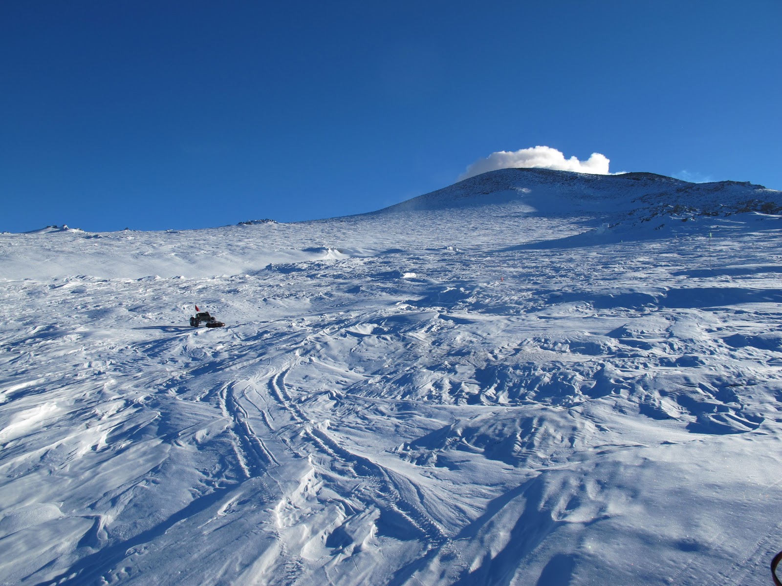
One last look at Mt. Erebus, outgassing volcanic steam and vapors on a perfect afternoon.

I got to ride up in the cockpit for a while, and the pilots from the National Air Guard gave me a walkthrough and answered some questions about the plane. I thought that our drive in the Case tractor, at 3 gallons per mile, was pretty poor fuel efficiency, but that's NOTHING compared to this beast. This trip to take me off the ice will burn 180,000 lbs of fuel, or approximately 35,000 gallons. I felt bad about commuting to work in a civic every day, but apparently this one trip alone will release 270 TONS of CO2, putting me at 67.5 times the average worldwide annual CO2 emissions per person for this one flight alone. That sounds unbelievable, but it's based on a burn rate of 7,000 gallons per hour, and 3 pounds of CO2 output for every pound of jet fuel burned (oxygen atoms are heavy...). The plane was bringing food and supplies down to McMurdo, so I'm just catching a ride on the way home, but it definitely doesn't give me warm fuzzies for being a good global citizen. I just found out that there were supposed to be another nine people on this flight, but somehow ALL NINE OTHER PEOPLE convinced the NSF that they had a good reason to stay for Halloween, and I was the only one without a good enough excuse :(


The sadly empty inside of my private C-17.

On Wednesday morning, we had several hours to perform the last test on Yeti. Since everything else worked out well, we wanted to show that we could program an autonomous run in which Yeti would traverse out across the ice to a predetermined point, then execute a rosette pattern over a simulated crevasse location to collect radar data from different approach angles to the crevasse. This should have been trivially simple, but required scaling up the number of waypoints we sent Yeti from 10 to 150. After finally getting everything set up, we sent Yeti out to execute a 1 mile run with two rosette pattern searches along the way. It perfectly executed the first, then stopped and waited for instructions. With 10 minutes remaining before we had to crate Yeti up to ship it back to NH, we had to stop the test and bring it home. I'm pretty sure that this is a trivially simple bug that caused Yeti to stop early. This is a capability we can easily demonstrate back in New Hampshire and an add-on to our original goals, but it was still a little frustrating that it didn't work without modification.


The view out the window on the way home.

I'll continue writing until I get home, on Sunday the 7th. I'll be holed up in a library in New Zealand furiously working away on projects for PSI until then. I need to thank everyone who helped make this trip possible. I'd principally like to thank Jim Lever and Professor Ray for creating this opportunity which began in 2007, and sticking with the project since that time to help in every possible way. Without their advice, guidance, and support, we'd never have made it off the drawing board. Our Greenland deployment, and subsequently this trip, would not have been possible without the sponsorship and support from Ken Corcoran and the folks at Geophysical Survey Systems Incorporated. Thanks also to my 190/290 project teammates who worked insane hours through 2007-2008 to build Yeti in the first place, and Chris, Taro, and Max who did the groundbreaking and exhaustively thorough initial conceptual chassis design. I wonder if they ever expected to see it get this far, I certainly have been pleasantly surprised. Finally, thanks to everyone else at Thayer who helped us along the way. Thanks to all of the support staff at McMurdo and with the USAP. They outnumber the scientists by 10:1 and work 6-days a week, 10 hours a day. Many of them come to Antarctica for the unique experience, but have to earn the right to be here by working insanely hard, many with irregularly rotating night shifts and without weekends. I also need to thank NASA's Jet Propulsion Lab for the initial education grant that funded us to build the robot, and the NSF for their continued support of our field operations in Greenland and Antarctica.

Lastly, but extremely importantly, I'd like to thank everyone at PSI for making it possible for me to take a few weeks off to be here. Initially it looked as though the scheduling would work out a lot better than it did in reality, and I need to thank Brian, Jay, Emily, Charlie, Pete, Peter, Marty, Jim, and especially Dave for picking up some of the slack while I'm gone. Now that I'm back, it'll be a few weeks of the 6-day 28-hour schedule to get caught up and prove my worth again :).