Field Day
On Tuesday we took Yeti back into the field for a surprise run. We expected to have the day to work on our code and perfect its autonomous behavior but the rest of the team was heading into the field and with great weather we had to try out our first fully autonomous long-distance run.
From the base of the transition, we pressed 'play' and watched as Yeti climbed up the glacier towards its first waypoint about 3km up the icesheet. Kevin and I struggled to keep up, bogged down with the toolstation and backpacks full of gear. Yeti climbed through the sastrugi field with the largest features about 2.5' tall without getting stuck once, holding its bearing well as it bumped around the rough terrain.
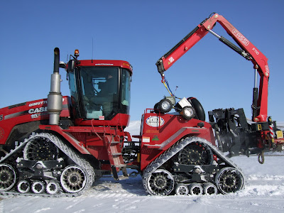
About 2 km up the glacier we heard Allan heading up the glacier on a snowmobile, and he told us we'd have to cut it short since people were heading in for the day. We hoisted Yeti up on the crane from the Case tractor and brought it back to base. We spend the rest of the night coding, logging a 17.5 hour work day.
Our radar record showed us very little about the ice surface since we apparently had the gains set such that it ignored most of the first layer. Allan showed us how to set the radar accordingly, which we changed for Today.
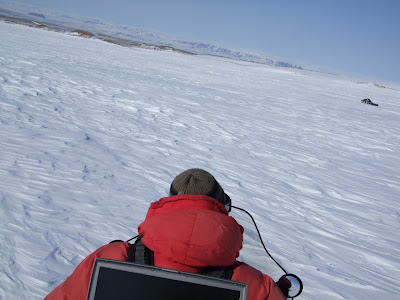
Today we got up again at 7 and packed up to head out to the field again. This time we decided to use a snow machine, and found out how ridiculously helpful it is. Running with a laptop on ice has proven pretty difficult, but laptoping on the back of a snowmobile worked out extremely well.
This time, we pressed play and Yeti repeated the climb, this time making it the entire 3km to the first waypoint before turning around and heading to the second point at the bottom of the glacier. The radar data looks great as far as we can tell, though we'll have to take a closer look at it when we have time tomorrow.
We've learned a lot about the system at this point and are pretty close to the point where it would be viable to use in conjunction with the sno-cat for the GPR work on a traverse. We've identified the things we need to improve to get it to the point where it could do the majority of the survey work. We've got our hands full updating the code, but we're encouraged by the results and have had great success so far. Our next major milestone is a fully hands-off long range run with GPS-tagged radar data, and we plan to do this run on Friday.
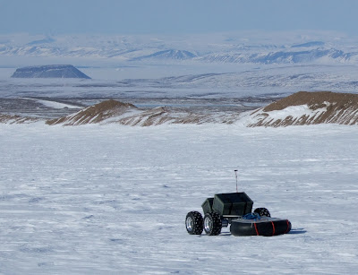
Yeti with mount Dundas in the distance
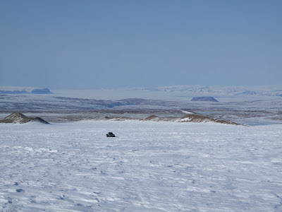
Looking out over the fjord filled in with sea ice in the distance
posted by Eric Trautmann @ 9:49 PM
1 Comments
![]()
![]()

1 Comments:
Eric,
Have you looked to verify if the GPS is being recorded?
Can you email data?
Ken
Post a Comment
Subscribe to Post Comments [Atom]
<< Home